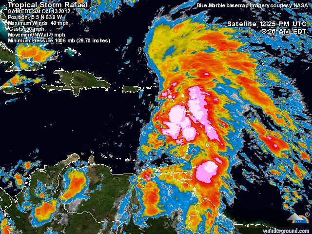

We finally have a storm worth writing about. This storm season has been so quiet compared to the fall of 2010, when we were drowning in rain. But Tropical Storm Rafael is due to hit us today - could be bad, could be nothing as these things go. The top image is a satellite image taken at 8 am this morning and I thought it was so dramatic that I'd put it on the blog. Its hard to see but St. Thomas is about 100km west of the storm front. But what was even more interesting is that from our perch on the hill the sky looks like the satellite image. I always figured we could see about 70km and I'm suspecting that we can see much further (could do a line of sight...plus the clouds are so high). The second picture, we have the normal scattered white fluffy clouds (cumulus) in the foreground, but in the back ground, where it appears blue is a high *wall* of dark clouds (which look blue in real life, but not the same blue as a clear sky), which would indicate the storm's front and all the clouds behind it for miles. Its hard to see in the picture I know, but its pretty dramatic and I cannot wait to see it on closer approach.
No comments:
Post a Comment